Woodroffe North
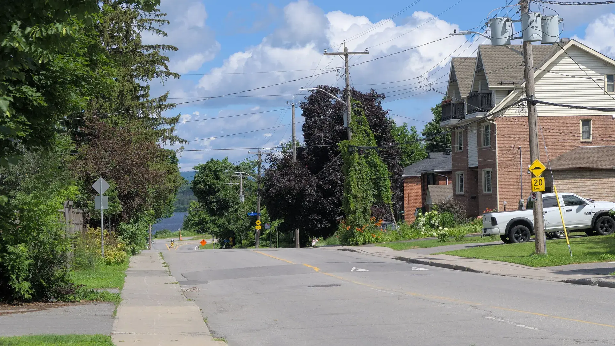
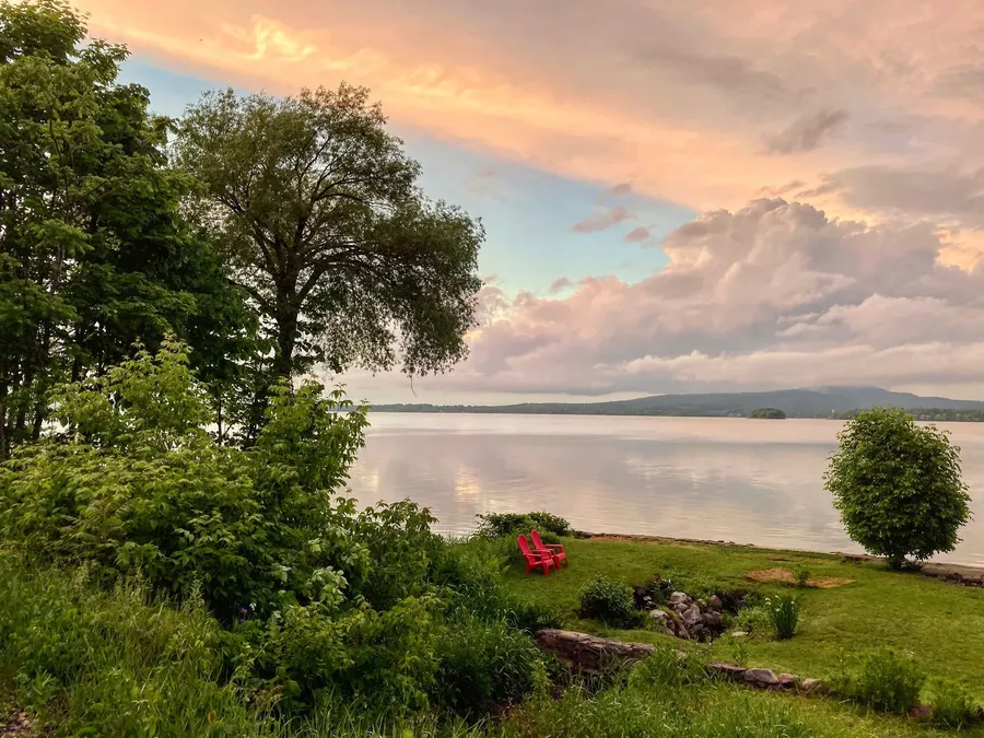
A small riverside enclave north of Richmond Road around Woodroffe Avenue, where early cottages have given way to houses.
* Ottawa Neighbourhood Study figures for its “Whitehaven - Woodpark - Glabar Park (includes Woodroffe North)” area, which is larger than Woodroffe North alone.
Woodroffe North, also called simply Woodroffe, is a small Bay Ward neighbourhood between Richmond Road and the Ottawa River around the north end of Woodroffe Avenue. From the Woodroffe North centre it is about 9 minutes to Our Lady Of Fatima School (OCSB, grades JK–6), 20 to Loblaws and 10 to the future Sherbourne O-Train station (under construction, opening listed for 2027) on foot (OSRM estimates). The Ottawa Neighbourhood Study's 'Whitehaven - Woodpark - Glabar Park (includes Woodroffe North)' area had 11,430 residents in the 2021 census.
Updated · Facts on this page link to their sources
From the Woodroffe North centre
Walking and driving times to the nearest schools, O-Train stations and grocery stores.
| To | Nearest | Walk | Route | Drive |
|---|---|---|---|---|
| Elementary school | Our Lady Of Fatima School (OCSB, grades JK–6) | 9 min | 670 m | 2 min |
| Elementary school | Woodroffe Avenue Public School (OCDSB, grades K–8) | 13 min | 970 m | 2 min |
| Secondary school | Nepean High School (OCDSB, grades 9–12) | 25 min | 1.9 km | 5 min |
| Secondary school | Notre Dame High School (OCSB, grades 7–12) | 30 min | 2.2 km | 6 min |
| O-Train (open) | Tunney's Pasture | 61 min | 4.6 km | 8 min |
| O-Train (under construction) | Sherbourne (opening listed for 2027, provisional) | 10 min | 750 m | 2 min |
| Grocery store | Loblaws | 20 min | 1.5 km | 4 min |
| Grocery store | Produce Depot | 29 min | 2.1 km | 5 min |
Estimates from OSRM on OpenStreetMap data: walking at about 5 km/h on streets and paths (no waits at crossings), driving in free-flowing traffic. Calculated 2026-10-30. Map data © OpenStreetMap contributors (ODbL).
About Woodroffe North
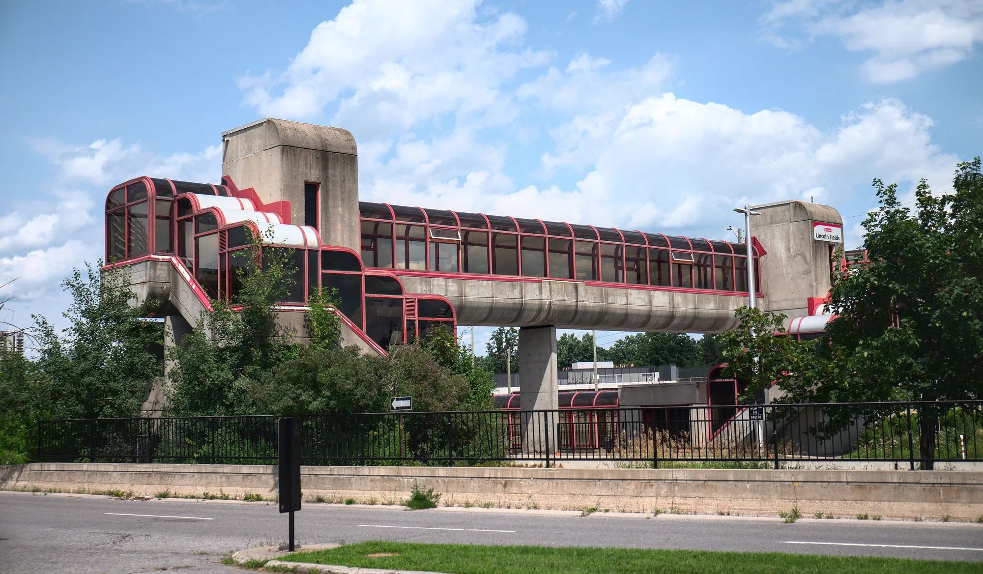
Woodroffe North, also called simply Woodroffe, is a small Bay Ward neighbourhood between Richmond Road and the Ottawa River around the north end of Woodroffe Avenue. Its homes began as cottages similar to those in Britannia, and most have since been replaced by houses. The name comes from the wider historic community of Woodroffe, where Ira Honeywell, Nepean's first European settler, bought land in 1809 and a streetcar line ran by 1900. It is close to the NCC riverfront pathways, Carlingwood Shopping Centre and the Carlingwood library, and the new Sherbourne and New Orchard O-Train stations are being built nearby.
Boundaries
Bounded by Richmond Road to the south, Pooler Avenue to the west, the Ottawa River (Kichi Zibi Mikan) to the north, and the northern extension of Sherbourne Road (the Cleary Avenue line) to the east (Wikipedia; matches the OpenStreetMap 'Woodroffe North' boundary). Wikipedia also says the Woodroffe North community includes residents on streets west of Woodroffe Avenue and that the area west of New Orchard Avenue is known as Ambleside. The historic Woodroffe community (Capital Heritage / Nepean Museum) was much larger, running from the Ottawa River to Carling Avenue with Pinecrest Creek on the west. en.wikipedia.org openstreetmap.org
Homes
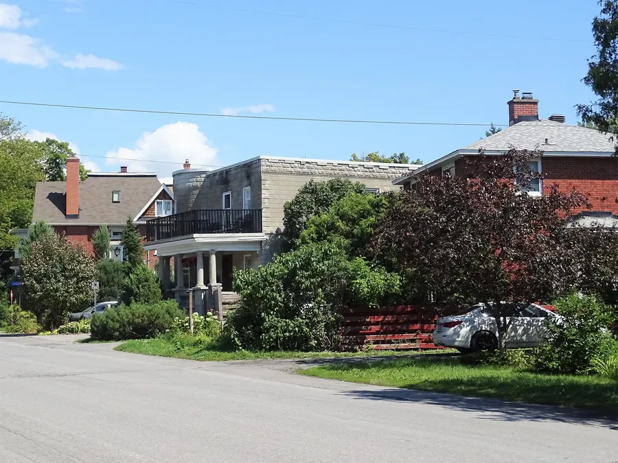
Former summer cottages, most now replaced by year-round houses. Wikipedia notes apartments and condominiums built in the 1970s on McEwen Avenue and Ambleside Drive just north of Richmond Road (the Ambleside area, which Wikipedia places west of New Orchard Ave and also describes in the Woodpark article). ONS counts this area in its broad 'Whitehaven - Woodpark - Glabar Park' area, which was 33.8% single-detached and 51.0% apartments in buildings of five or more storeys in 2021. en.wikipedia.org en.wikipedia.org
- Riverside location between Richmond Road and the Ottawa River, by the NCC Capital Pathway
- Woodroffe Park (~0.46 km): outdoor rink, wading pool and play structure
- Our Lady of Fatima School (~0.31 km) and Woodroffe Avenue Public School (~0.69 km) are close by; confirm boundaries with each board
- Carlingwood Shopping Centre (~0.93 km) and the Carlingwood library branch (~0.82 km)
- Future Sherbourne (~0.36 km) and New Orchard (~0.63 km) O-Train stations, listed for 2027
- Winter Fun Day at Woodroffe Park, co-hosted by the Carlingwood and Woodroffe North community associations
- Named for one of Nepean's oldest settled areas (first settler Ira Honeywell, 1809)
Community
- Woodroffe North Community Association (WNCA) carlingwoodhood.wixsite.com
How Woodroffe North came to be
- 1809
In June 1809 Ira Honeywell bought Lot 26 of the First Concession, becoming Nepean's first European settler; he built a log cabin in 1810 and moved his family there in 1811. capitalheritage.ca
- 1900
By 1900 a streetcar line ran through Woodroffe; the local post office operated from 1905 to 1957, and a four-room schoolhouse opened in 1913. capitalheritage.ca
The name Woodroffe comes from a country estate in Tipperary, Ireland, which Captain G.W. Baker chose for his Richmond Road residence on Lot 25. capitalheritage.ca
The homes were originally cottages similar to those in Britannia; most were demolished and replaced by houses. en.wikipedia.org
Local names worth knowing
- Ira Honeywell
Nepean's first European settler, who bought Lot 26 of the First Concession in the Woodroffe area in 1809. capitalheritage.ca
- Captain G.W. Baker
Named his Richmond Road residence after the Woodroffe estate in Tipperary, Ireland, the source of the area's name. capitalheritage.ca
Around Woodroffe North
Walking rings at 5, 10 and 15 minutes from the neighbourhood centre.
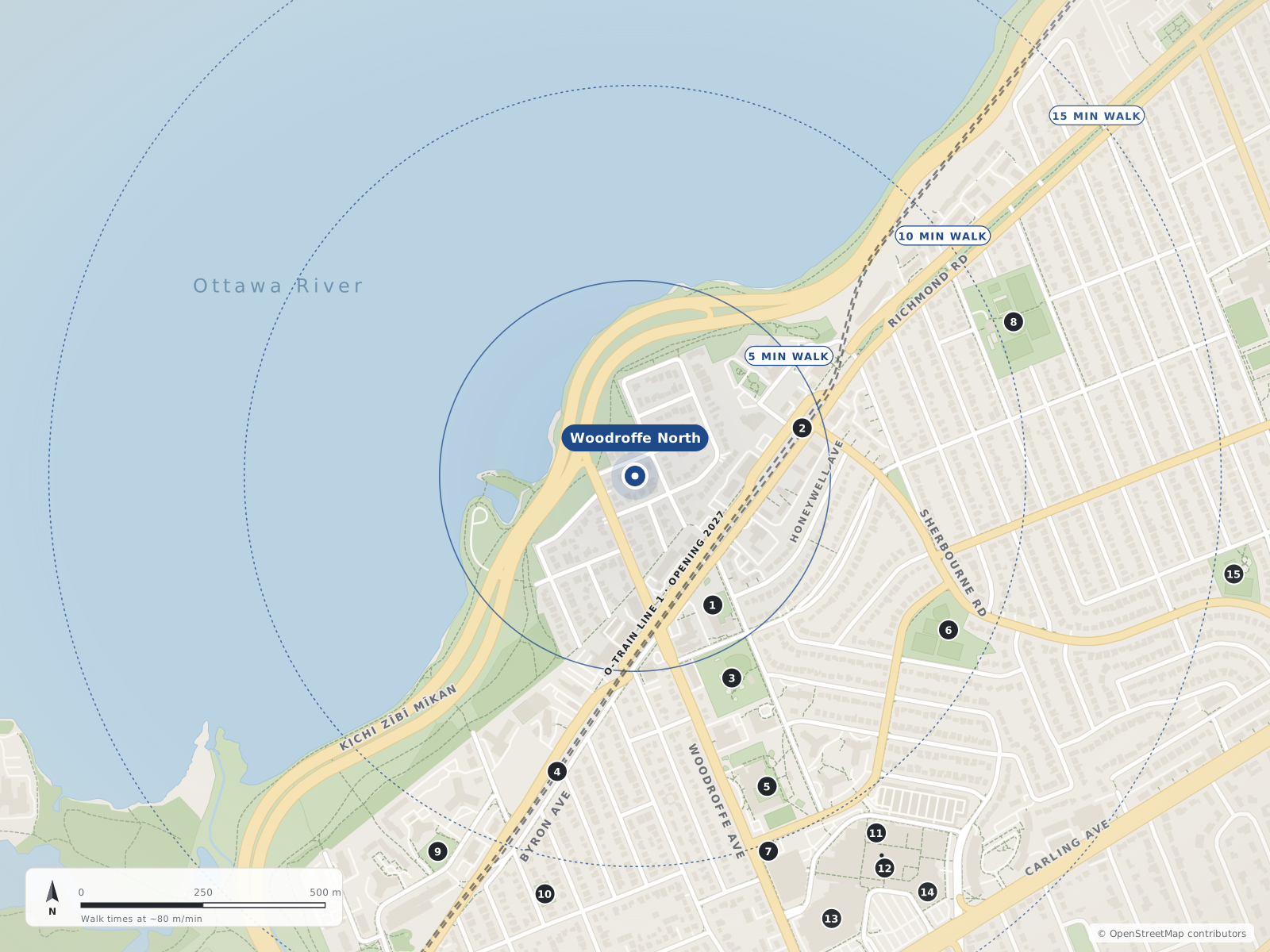
- 1Our Lady Of Fatima School310 m
- 2Sherbourne360 m
- 3Woodroffe Park460 m
- 4New Orchard630 m
- 5Woodroffe Avenue PS690 m
- 6Westwood Park720 m
- 7Ottawa Public Library - Carlingwood Branch820 m
- 8McKellar Park840 m
- 9Ambleside Park870 m
- 10New Orchard Park880 m
- 11Coles890 m
- 12Carlingwood Shopping Centre930 m
- 13Canadian Tire1.0 km
- 14Loblaws1.0 km
- 15David Shentow Park1.2 km
Schools
5 nearbyOur Lady Of Fatima School
OCSBGrades JK–62135 Knightsbridge Roadopenstreetmap.org olf.ocsb.ca
310 m4 min walkWoodroffe Avenue Public School
OCDSBGrades K–8235 Woodroffe Avenueopenstreetmap.org woodroffeaveps.ocdsb.ca
690 m9 min walkNepean High School
OCDSBGrades 9–12574 Broadview Avenueopenstreetmap.org nepeanhs.ocdsb.ca
1.3 km16 min walkBroadview Public School
OCDSBGrades JK–8590 Broadview Avenueopenstreetmap.org broadviewps.ocdsb.ca
1.4 km17 min walkNotre Dame High School
OCSBGrades 7–12710 Broadview Avenueopenstreetmap.org ndh.ocsb.ca ndh.ocsb.ca
1.5 km18 min walk
Straight-line distances from the Woodroffe North centre. Living near a school does not guarantee a place: confirm the designated school for an address with each board. All schools and board locators.
Parks & places
9 nearbyWoodroffe Park
City park with a fieldhouse, a supervised outdoor rink and a wading pool (per OSM/City data).
180 Lockhart Avenueopenstreetmap.org openstreetmap.org openstreetmap.org
460 m6 min walkWestwood Park
City of Ottawa neighbourhood park on Saville Row (dogs allowed per OSM).
2000 Saville Rowopenstreetmap.org
720 m9 min walkOttawa Public Library - Carlingwood Branch
Three-storey Ottawa Public Library branch with a children's department, meeting room and Friends of OPL used book store; reopened Sept 14, 2026 after Canada Day 2026 storm damage (some programs/children's collection initially limited).
281 Woodroffe Avenueopenstreetmap.org about.biblioottawalibrary.ca forms.biblioottawalibrary.ca
820 m10 min walkMcKellar Park
City park with the McKellar Park Fieldhouse (programs run by the Dovercourt Recreation Association), a supervised double-surface outdoor rink and a wading pool.
539 Wavell Avenueopenstreetmap.org openstreetmap.org openstreetmap.org
840 m10 min walkAmbleside Park
Park on Ambleside Drive (dogs allowed per OSM).
1083 Ambleside Driveopenstreetmap.org
870 m11 min walkNew Orchard Park
City park on New Orchard Avenue.
243 New Orchard Avenueopenstreetmap.org
880 m11 min walkDavid Shentow Park
City park on Tillbury Avenue West (leashed dogs per OSM).
590 Tillbury Avenue Westopenstreetmap.org
1.2 km16 min walkByron Linear Tramway Park
Linear City park along the former Byron streetcar corridor; it hosts the Westboro Farmers' Market on Saturdays (May 16 – Oct 31, 2026), and the underground Sherbourne and New Orchard O-Train stations are being built along its western end.
579 Byron Avenueopenstreetmap.org ottawafarmersmarket.ca en.wikipedia.org
1.3 km16 min walkGlabar Park
City park on Hare Avenue in Glabar Park (dogs allowed per OSM).
845 Hare Avenueopenstreetmap.org
1.3 km17 min walk
Shops & dining
6 nearbyColes
Coles bookstore inside Carlingwood Shopping Centre.
2121 Carling Avenueopenstreetmap.org
890 m11 min walkCarlingwood Shopping Centre
Enclosed mall opened in 1956 with about 100 stores; anchors include Loblaws and a Canadian Tire flagship (opened 2022).
2121 Carling Avenueopenstreetmap.org en.wikipedia.org
930 m12 min walkCanadian Tire
Canadian Tire store at Carlingwood (hardware, home and sporting goods), opened 2022.
2165 Carling Avenueopenstreetmap.org en.wikipedia.org
1000 m12 min walkLoblaws
Full-service Loblaws supermarket at Carlingwood.
2085 Carling Avenueopenstreetmap.org
1.0 km13 min walkTrailhead Paddle Shack
Outdoor/paddling shop on Carling Avenue.
2148 Carling Avenueopenstreetmap.org
1.3 km16 min walkProduce Depot
Greengrocer (produce store) on Carling Avenue.
1855 Carling Avenueopenstreetmap.org
1.5 km19 min walk
Getting around
TransitSherbourne
Future underground O-Train station along the Byron Linear Tramway Park / Richmond Road corridor. Not open as of Oct 2026. OC Transpo (Mar 12, 2026) expected handover to the City in Q2 2027 and passenger service in Q3 2027; Canada Day 2026 flooding damaged parts of the extension between New Orchard and Moodie and OC Transpo has said it may open the extension in parts (CTV, Aug 5, 2026).
under constructionopenstreetmap.org octranspo.com en.wikipedia.org
360 m4 min walkNew Orchard
Future underground O-Train station near New Orchard Avenue; OC Transpo reported faregates installed and interior finishing nearing completion in 2025. Not open as of Oct 2026. OC Transpo (Mar 12, 2026) expected handover to the City in Q2 2027 and passenger service in Q3 2027; Canada Day 2026 flooding damaged parts of the extension between New Orchard and Moodie and OC Transpo has said it may open the extension in parts (CTV, Aug 5, 2026).
under constructionopenstreetmap.org octranspo.com en.wikipedia.org
630 m8 min walkWoodroffe Avenue bus corridor
North–south street past the Carlingwood library; OSM bus route relations include 51, 87 and 153. Confirm on octranspo.com.
openopenstreetmap.org overpass-api.de
760 m9 min walkCarling Avenue bus corridor
Arterial past Carlingwood Shopping Centre; OSM bus route relations on Carling Avenue in the area include 51, 81, 85, 87, 153 and shopper routes 301/303/305. Confirm on octranspo.com.
openopenstreetmap.org overpass-api.de
1.1 km14 min walkFuture O-Train
Sherbourne (~0.36 km) and New Orchard (~0.63 km) stations, underground in the Byron Linear Tramway Park, on the Line 1 west extension listed for 2027. Lincoln Fields, a little farther south-west, will be the Line 1 / Line 3 junction.
O-Train timing caveat
CTV reported the west extension launch delayed to summer 2027 (Mar 12, 2026) and that Canada Day 2026 flood damage could mean a partial opening (Aug 5, 2026).
Bus (OC Transpo)
Wikipedia says the adjoining Woodpark is served by buses on Carling, Woodroffe and Richmond Road. Confirm current routes on octranspo.com.
Cycling
NCC riverside pathway along the Kichi Zibi Mikan.
For sale in Woodroffe North
No Woodroffe North homes on westboro.homes right now
Selling here? Get a website for your home, or browse every home for sale in the area.
Neighbouring areas
Quick answers
Short answers first; each links to the full answer and its sources.
Where is Woodroffe North, and what kind of homes are there?
Woodroffe North is a small Bay Ward neighbourhood between Richmond Road and the Ottawa River around the north end of Woodroffe Avenue, west to Pooler Avenue. Its homes began as summer cottages, and most have since been replaced by year-round houses.
As of 2026-10-30 · en.wikipedia.org openstreetmap.org
What schools are closest to Woodroffe North, Ottawa?
From the Woodroffe North centre, Our Lady of Fatima School (OCSB, JK–6) is about a 9-minute walk and Woodroffe Avenue Public School (OCDSB, K–8) about 13 minutes. Nepean High School is about 25 minutes and Notre Dame High School about 30 minutes on foot.
As of 2026-10-30 · westboro.homes openstreetmap.org
Where is the nearest public library to Westboro and Carlingwood?
The Ottawa Public Library's Carlingwood branch is at 281 Woodroffe Avenue. It reopened on September 14, 2026 after storm damage on Canada Day 2026, and has a children's department, a meeting room and a Friends of OPL used book store.
As of 2026-10 · about.biblioottawalibrary.ca forms.biblioottawalibrary.ca
Who lives in Woodroffe North?
Census figures are only published for the Ottawa Neighbourhood Study's wider 'Whitehaven - Woodpark - Glabar Park' area, which contains Woodroffe North. In 2021 it had 11,430 residents, a median age of 50.4, and 43.2% of households renting.
As of 2021 · ons-sqo.ca ons-sqo.ca
Where does the name Woodroffe come from?
The name comes from a country estate in Tipperary, Ireland, which Captain G.W. Baker chose for his residence on Richmond Road. The historic community of Woodroffe was one of Nepean's oldest settled areas: Ira Honeywell, Nepean's first European settler, bought land there in June 1809.
As of 2026-10-30 · capitalheritage.ca