Parks & trails
The Ottawa River runs the whole length of the area's north edge. Between it and Carling Avenue are a beach, a riverside pathway, an old streetcar line turned park, and neighbourhood parks with rinks and wading pools.
28 parks, beaches, pathways and recreation places are mapped in the Westboro area: 22 parks, 1 beach, 2 pathways and trails and 3 recreation centres and libraries. Along the river are Westboro Beach and Ottawa River Pathway (Trans Canada Trail), Kichi Sibi Winter Trail.
Updated · Facts on this page link to their sources
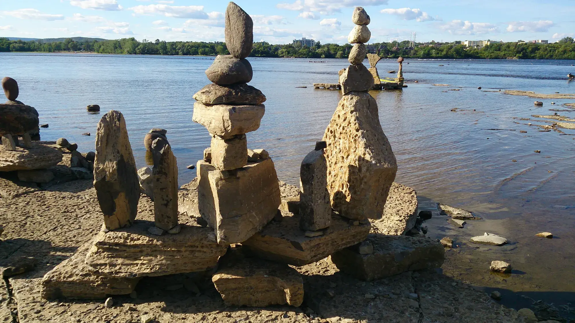
Along the river, the National Capital Commission manages Westboro Beach, with a supervised swim area in summer, and the Ottawa River Pathway, part of the NCC's Capital Pathway network of more than 200 km of off-road paths. In winter, the volunteer-groomed Kichi Sibi Winter Trail follows the shore for skiing, snowshoeing and walking.
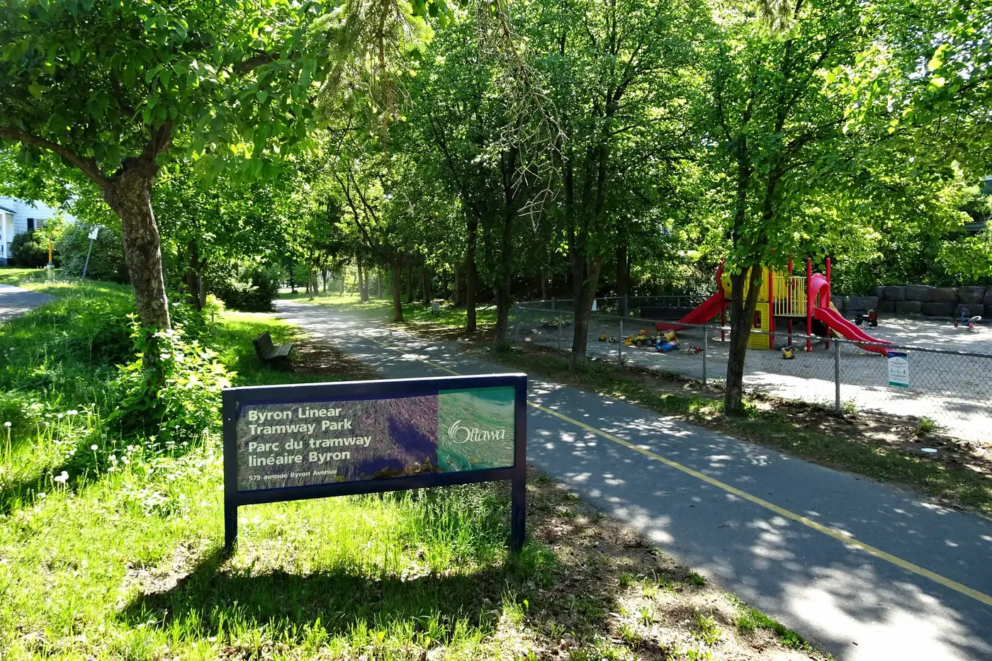
Inland, City parks such as McKellar Park, Woodroffe Park and Westboro Kiwanis Park have supervised outdoor rinks in winter and wading pools in summer. The Byron Linear Tramway Park follows the old Byron streetcar line and hosts the Westboro Farmers' Market on Saturdays from May to October.
The Ottawa River Pathway is a car-free route along the river, east toward downtown and west along the shore.
Parks, beaches and paths
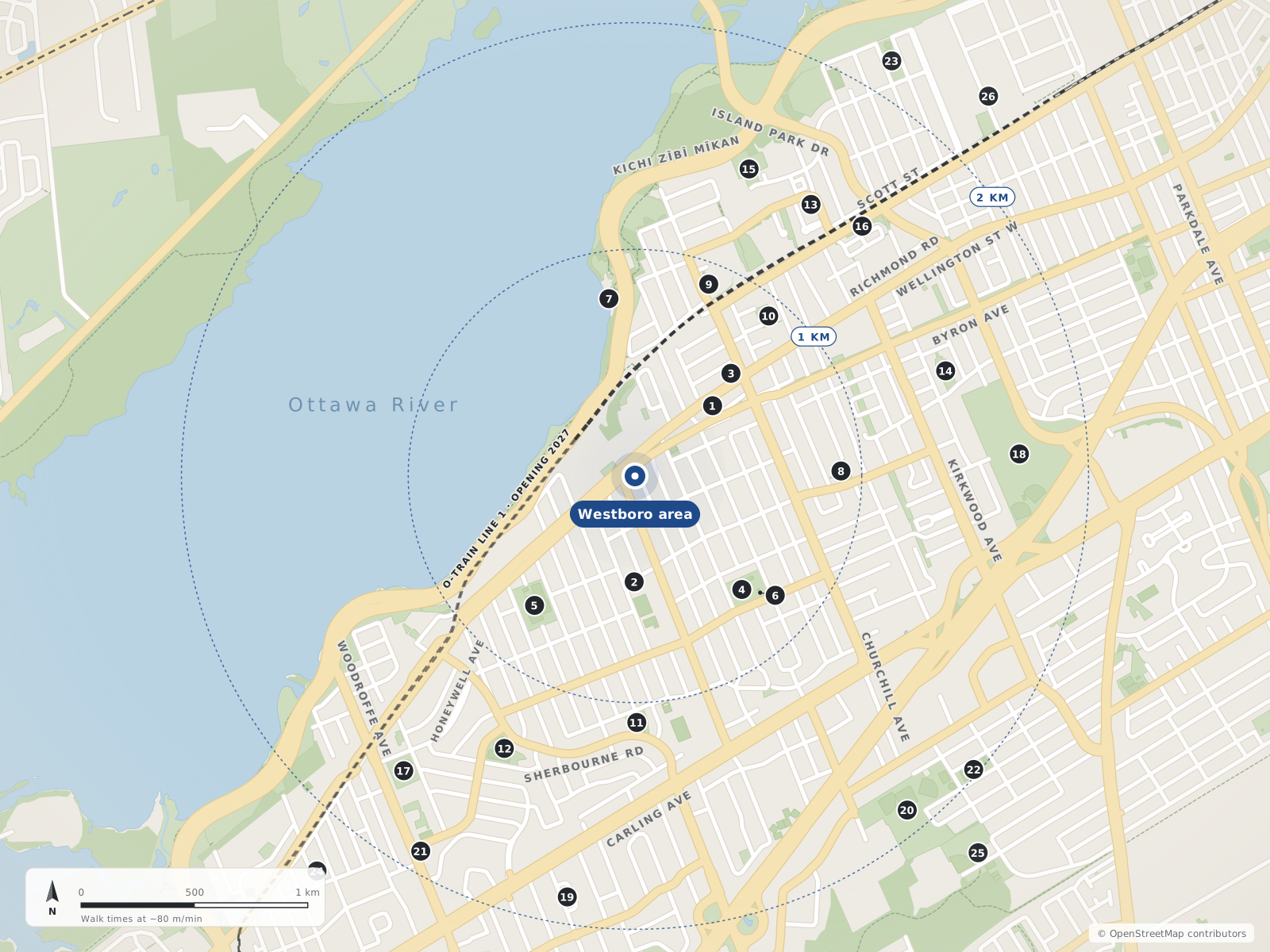
- 1Ottawa River Pathway (Trans Canada Trail)460 m
- 2Byron Linear Tramway Park470 m
- 3Churchill Seniors Recreation Centre620 m
- 4Westboro Kiwanis Park710 m
- 5McKellar Park720 m
- 6Dovercourt Recreation Centre760 m
- 7Westboro Beach790 m
- 8Clare Gardens Park910 m
- 9Roy Duncan Park910 m
- 10Lion's Park920 m
- 11David Shentow Park1.1 km
- 12Westwood Park1.3 km
- 13Mahoney Park1.4 km
- 14Iona Park1.4 km
- 15Riverside Terrace Park1.4 km
- 16Heather Crowe Park1.5 km
- 17Woodroffe Park1.7 km
- 18Hampton Park1.7 km
- 19Glabar Park1.9 km
- 20Carlington Park1.9 km
- 21Ottawa Public Library - Carlingwood Branch1.9 km
- 22Raven Park2.0 km
- 23Champlain Park2.2 km
- 24New Orchard Park2.2 km
- 25Bellevue Manor Park2.2 km
- 26Kichi Sibi Winter Trail2.3 km
The river & beaches
1Westboro Beach
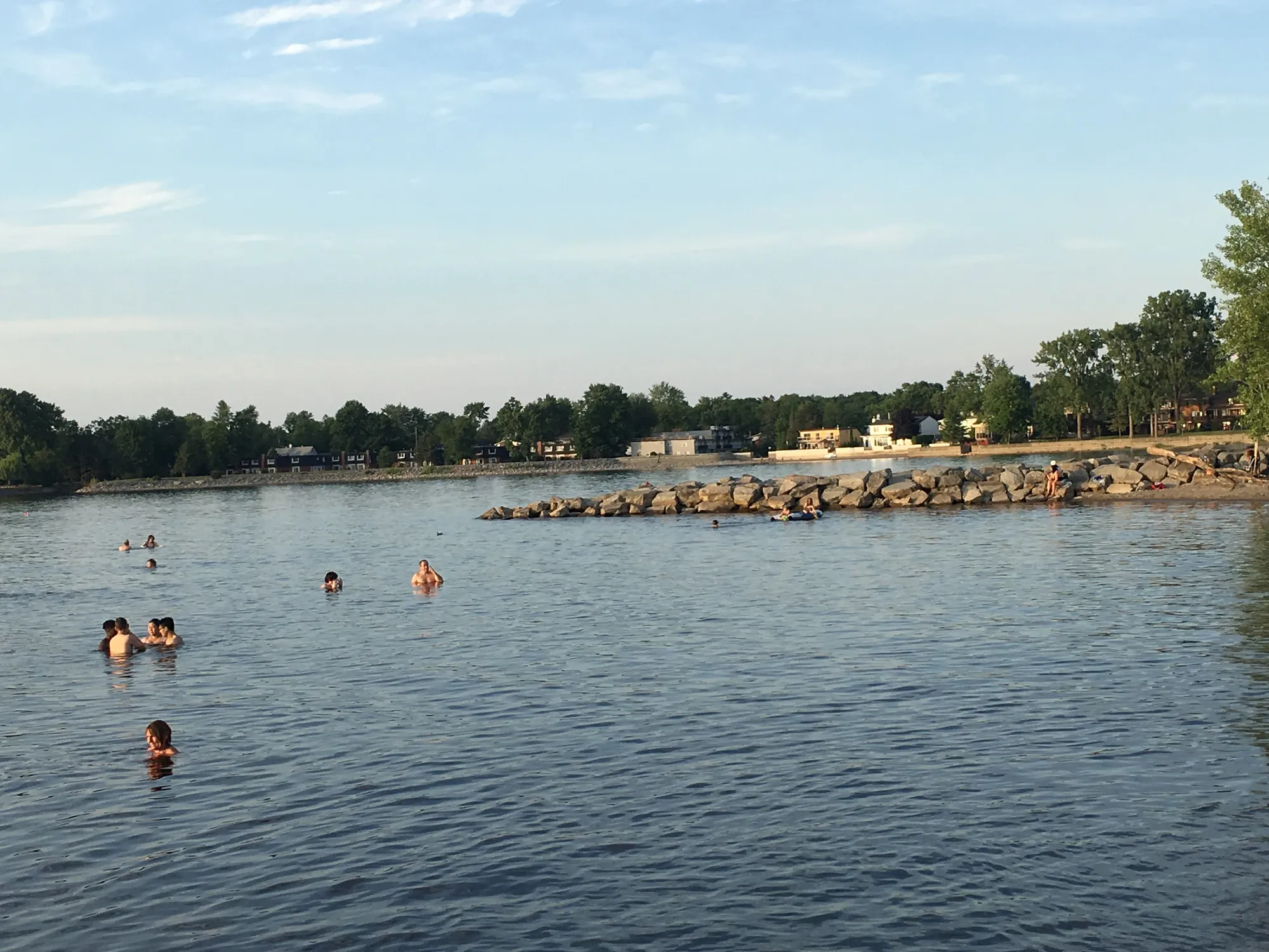
NCC-managed sandy beach on the Ottawa River with a designated supervised swim area in summer; the renovated site has pavilions, a year-round restaurant (the Grand Pizzeria) and a seasonal café, and in winter the Kichi Sibi Winter Trail leads directly to the pavilion.
NCC745 Kichi Zībī MīkanIn Westboro Beachopenstreetmap.org openstreetmap.org ncc-ccn.gc.ca
Pathways & trails
2Ottawa River Pathway (Trans Canada Trail)
Multi-use cycling and walking pathway along the Ottawa River, part of the NCC's Capital Pathway network (200+ km of off-road pathways) and mapped in OSM as part of the Trans Canada Trail.
NCCIn Highland Parkopenstreetmap.org ncc-ccn.gc.ca openstreetmap.org
Kichi Sibi Winter Trail
Volunteer-groomed multi-use urban winter trail along the Ottawa River (NCC: ski, snowshoe, snow bike or hike); per the NCC it leads directly to Westboro Beach.
Kichi Sibi Winter Trail (volunteers)openstreetmap.org wintertrail.ca ncc-ccn.gc.ca
Neighbourhood parks
22Ambleside Park
Park on Ambleside Drive (dogs allowed per OSM).
City of Ottawa1083 Ambleside DriveIn Woodroffe Northopenstreetmap.org
Byron Linear Tramway Park
Linear City park along the former Byron streetcar corridor; it hosts the Westboro Farmers' Market on Saturdays (May 16 – Oct 31, 2026), and the underground Sherbourne and New Orchard O-Train stations are being built along its western end.
City of Ottawa579 Byron AvenueIn Highland Parkopenstreetmap.org ottawafarmersmarket.ca en.wikipedia.org
Clare Gardens Park
Small City park on Clare Street in Westboro (no dogs per OSM).
City of Ottawa269 Clare StreetIn Westboroopenstreetmap.org
David Shentow Park
City park on Tillbury Avenue West (leashed dogs per OSM).
City of Ottawa590 Tillbury Avenue WestIn McKellar Parkopenstreetmap.org
Glabar Park
City park on Hare Avenue in Glabar Park (dogs allowed per OSM).
City of Ottawa845 Hare AvenueIn Carlingwoodopenstreetmap.org
Heather Crowe Park
City park on Scott Street (leashed dogs per OSM).
City of Ottawa1902 Scott StreetIn Westboroopenstreetmap.org
Lion's Park
City park on Elmgrove Avenue beside the Ottawa Gymnastics Centre, with the Lions summer wading pool.
City of Ottawa294 Elmgrove AvenueIn Westboroopenstreetmap.org openstreetmap.org ottawa.ca
Mahoney Park
City park on Lanark Avenue.
City of Ottawa160 Lanark AvenueIn Westboro Beachopenstreetmap.org
McKellar Park
City park with the McKellar Park Fieldhouse (programs run by the Dovercourt Recreation Association), a supervised double-surface outdoor rink and a wading pool.
City of Ottawa539 Wavell AvenueIn McKellar Parkopenstreetmap.org openstreetmap.org openstreetmap.org
New Orchard Park
City park on New Orchard Avenue.
City of Ottawa243 New Orchard AvenueIn Woodroffe Northopenstreetmap.org
Riverside Terrace Park
City park on Clearview Avenue near the river (dogs allowed per OSM).
City of Ottawa225 Clearview AvenueIn Westboro Beachopenstreetmap.org
Roy Duncan Park
City park on Churchill Avenue North; the Paul Dewar Field House is nearby on an Ottawa Community Housing site.
City of Ottawa295 Churchill Avenue NorthIn Westboro Beachopenstreetmap.org openstreetmap.org
Westboro Kiwanis Park
City park beside the Dovercourt Recreation Centre with a supervised outdoor rink in winter and the Westboro wading pool in summer (per OSM/City data).
City of Ottawa411 Dovercourt AvenueIn Highland Parkopenstreetmap.org openstreetmap.org openstreetmap.org
Westwood Park
City of Ottawa neighbourhood park on Saville Row (dogs allowed per OSM).
City of Ottawa2000 Saville RowIn Carlingwoodopenstreetmap.org
Woodroffe Park
City park with a fieldhouse, a supervised outdoor rink and a wading pool (per OSM/City data).
City of Ottawa180 Lockhart AvenueIn Carlingwoodopenstreetmap.org openstreetmap.org openstreetmap.org
Bate Island Park
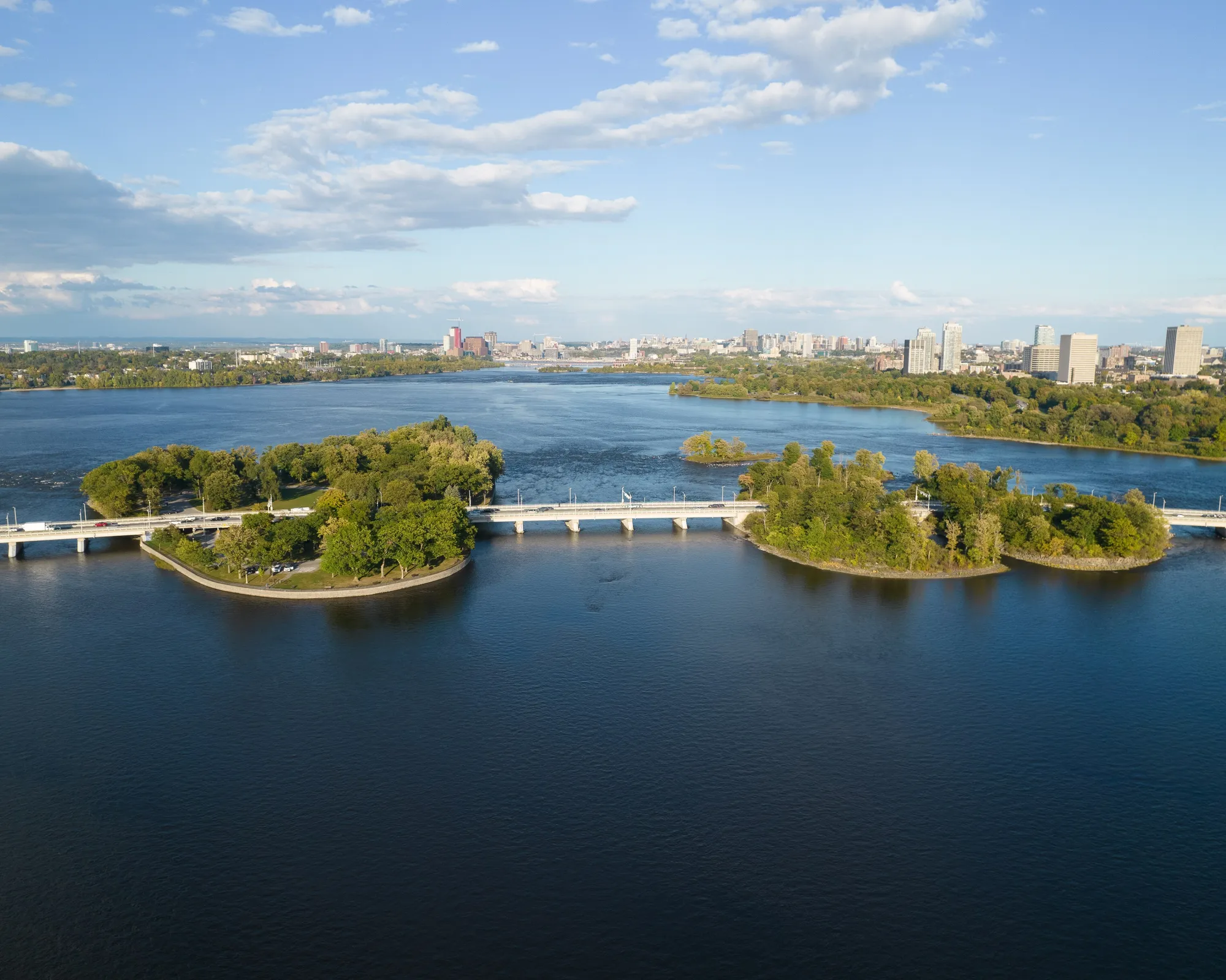
NCC island park in the Ottawa River under the Champlain Bridge with picnic areas and river access points.
Bellevue Manor Park
City park beside the Carlington Recreation Centre with a supervised outdoor rink and a wading pool.
City of Ottawa1520 Caldwell Avenueopenstreetmap.org openstreetmap.org openstreetmap.org
Carlington Park
City park on Clyde Avenue North near the J. A. Dulude Arena.
City of Ottawa937 Clyde Avenue Northopenstreetmap.org openstreetmap.org
Champlain Park
City park in Champlain Park with an outdoor rink (community building), a wading pool and the Champlain Field House nearby.
City of Ottawa140 Carleton Avenueopenstreetmap.org openstreetmap.org openstreetmap.org
Hampton Park
NCC park on Parkview Road with a City wading pool (a fenced off-leash dog area is mapped nearby in OSM).
NCC645 Parkview Roadopenstreetmap.org openstreetmap.org ottawa.ca
Iona Park
City park on Iona Street with a summer wading pool.
City of Ottawa223 Iona Streetopenstreetmap.org openstreetmap.org ottawa.ca
Raven Park
City park on Larose Avenue with a supervised outdoor rink and a wading pool.
City of Ottawa1500 Larose Avenueopenstreetmap.org openstreetmap.org openstreetmap.org
Recreation centres & libraries
3Churchill Seniors Recreation Centre
City of Ottawa seniors' recreation centre on Richmond Road in Westboro.
City of Ottawa345 Richmond RoadIn Westboroopenstreetmap.org
Dovercourt Recreation Centre
City recreation centre run with the Dovercourt Recreation Association: indoor pool with swim lessons and drop-in swims, fitness centre, pickleball, afterschool program, camps and a café; the Westboro wading pool, Westboro Kiwanis Park rink and a skateboard park are on the same site.
City of Ottawa / Dovercourt Recreation Association411 Dovercourt AvenueIn Highland Parkopenstreetmap.org dovercourt.org openstreetmap.org
Ottawa Public Library - Carlingwood Branch
Three-storey Ottawa Public Library branch with a children's department, meeting room and Friends of OPL used book store; reopened Sept 14, 2026 after Canada Day 2026 storm damage (some programs/children's collection initially limited).
Ottawa Public Library281 Woodroffe AvenueIn Carlingwoodopenstreetmap.org about.biblioottawalibrary.ca forms.biblioottawalibrary.ca
Quick answers
Short answers first; each links to the full answer and its sources.
Can you swim at Westboro Beach, and what is there?
Yes. Westboro Beach is an NCC-managed sandy beach on the Ottawa River with a designated supervised swim area in summer. It reopened on June 1, 2025 after a $21 million redevelopment that added a zero-carbon pavilion with a year-round restaurant and a seasonal café.
As of 2026-10 · ncc-ccn.gc.ca ncc-ccn.gc.ca
What parks are in Westboro?
Parks in and around Westboro include Westboro Kiwanis Park beside the Dovercourt Recreation Centre (outdoor rink and wading pool), Lion's Park (wading pool), Clare Gardens Park and the Byron Linear Tramway Park on the old streetcar line. The Ottawa River Pathway and Westboro Beach run along the area's northern edge.
As of 2026-10-30 · openstreetmap.org openstreetmap.org
When is the Westboro Farmers' Market?
The Ottawa Farmers' Market's Westboro location runs in the Byron Linear Tramway Park every Saturday from 9 am to 3 pm. The 2026 season ran from May 16 to October 31 with more than 60 local vendors.
As of 2026-10 · ottawafarmersmarket.ca openstreetmap.org
Where are the outdoor rinks and wading pools near Westboro?
City parks with supervised outdoor rinks in winter and wading pools in summer include Westboro Kiwanis Park, McKellar Park, Woodroffe Park, Champlain Park and Raven Park. Iona Park, Lion's Park and Hampton Park have wading pools.
As of 2026-10-30 · openstreetmap.org openstreetmap.org
What is there to do outdoors in winter in Westboro?
The volunteer-groomed Kichi Sibi Winter Trail follows the Ottawa River shore for skiing, snowshoeing, fat-biking and walking, and the NCC says it leads directly to Westboro Beach. City parks such as Westboro Kiwanis, McKellar and Woodroffe parks have supervised outdoor rinks.
As of 2026-10-30 · wintertrail.ca ncc-ccn.gc.ca
Can you bike from Westboro to downtown Ottawa?
Yes. The NCC's Ottawa River Pathway runs along the river at the north edge of the area and is a car-free walking and cycling route east toward downtown and west along the shore. It is part of the NCC's Capital Pathway network of more than 200 km of off-road paths.
As of 2026-10-30 · ncc-ccn.gc.ca openstreetmap.org